


Souq el Gharb (Lebanon 1983) - 15mm Wargame
Map complete - starting counters
Okay, the map is now complete. It’s actually complete whether I like it or not, apparently this afternoon I didn’t save it properly as editable layers … so large scale changes are lo longer possible without re-drawing the whole thing. Apparently the gods are trying to tell me something …
It’s fine! Stop obsessing and get some sleep!
I chose this sector for a number of reasons …
- My two players wanted to try British units (reasonable enough).
- Pretty sure Gold was “tougher” than Sword.
- This part of Gold (“Jig” Sector, turning west inland to fight toward Arromaches in “Item” Sector) is one of the few times we see British seaborne infantry actually fight true German troops that day (as opposed to “Ost” battalions, largely drawn from Belarus and Ukraine).
- We get some Royal Marine Commandos in the second wave (and after all this Falklands work, I loves me some Royal Marine Commandos).
- Two squadrons of tanks also land here (Sherwood Rangers – I think later renamed the Nottinghamshire Rangers?)
- The terrain here is interesting, with substantial towns right on the water, tough German beach defenses and “wiederstandnester” strongpoints, cliffs to the west leading toward Arromanches (about 20 hexes off off the west edge of the map), marshes and farmland (which are still here today), and even a small river which … rather bizarrely, never reaches the sea (?), apparently diverted east to a series of canals and marshland.
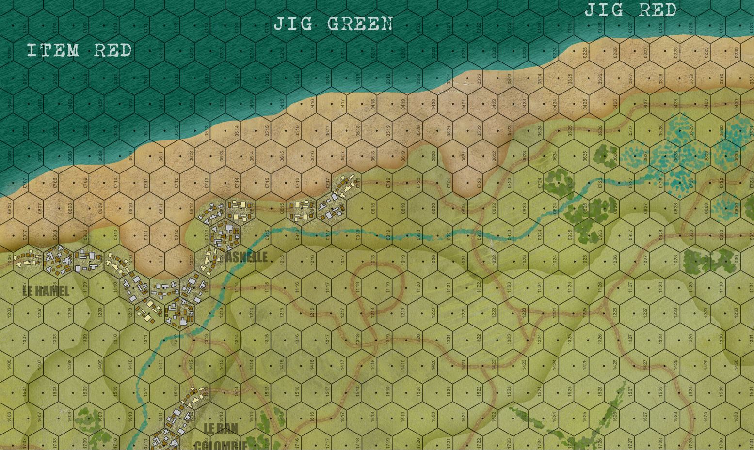 So here is the top third of the map. Each hex is 150 meters across, and so would fit two 6' Bolt Action tables end-to-end, or one 5' Flames of War table. We're going to be landing three battalions of infantry here, plus commandos, plus two squadrons of tanks, AVREs, etc. In all, about 2200 men and 30 tanks, plus bulldozers, flails, maybe even a platoon of AVRE Churchills (if we cheat slightly with the strict historical timeline and landing schedule).
 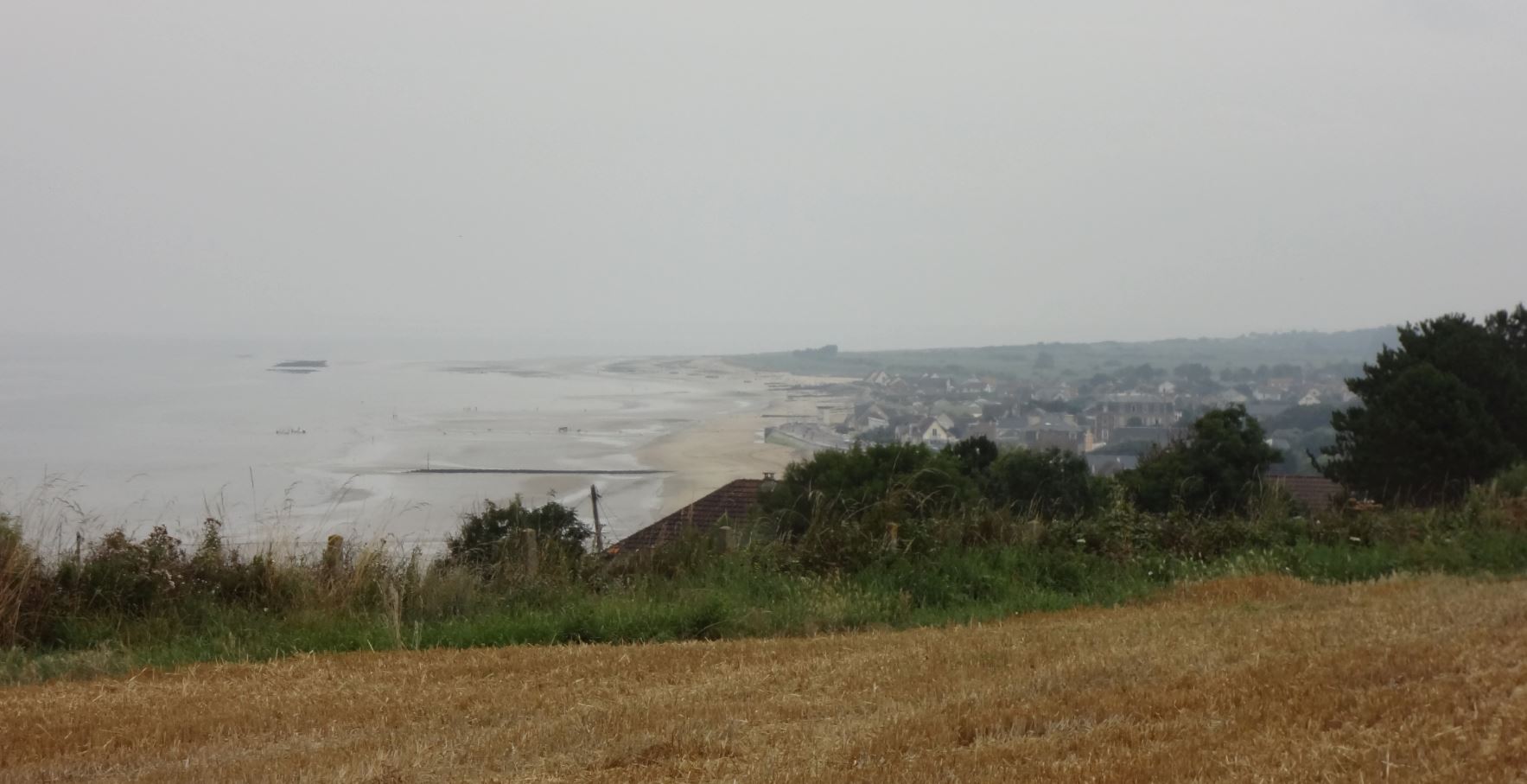 A few years ago I travelled to ALL the Normandy beaches, landing zones, and battlefields, from Pointe du Hoc to Falaise. These are some of my photographs of Gold Beach. This is looking east from atop the bluffs east of Arromanches, so I believe this is looking down onto either Jig or King Sector assault beaches. The trip was a few years ago. Either way, the beaches on our Panzer Leader board look a lot like this.
 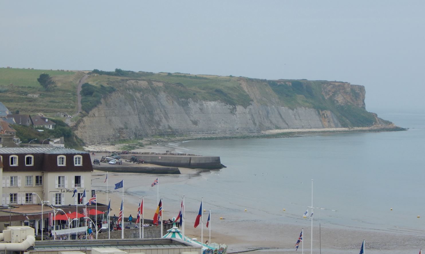 Looking west across the beach at Arromanches. This was in Item sector, and so far as I can tell wasn't actually "landed" on on D-Day, but assaulted from the east by troops that landed earlier in the day on Jig (231st Brigade, 1st Dorsetshire, 1st Hampshire, later 2nd Devonshire and 47th Royal Marine Commando).
 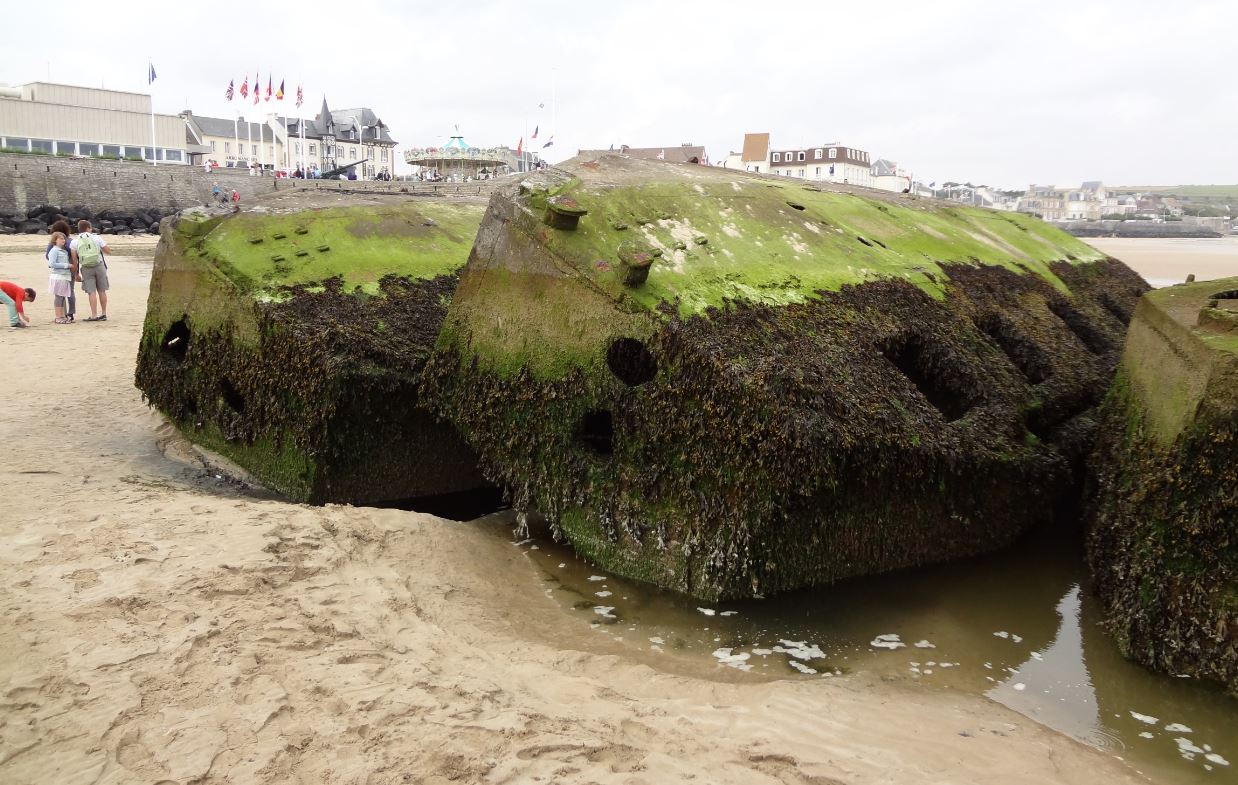 75 years later, the remains of "Port Winston" Mulberry artificial harbor is still in place.
 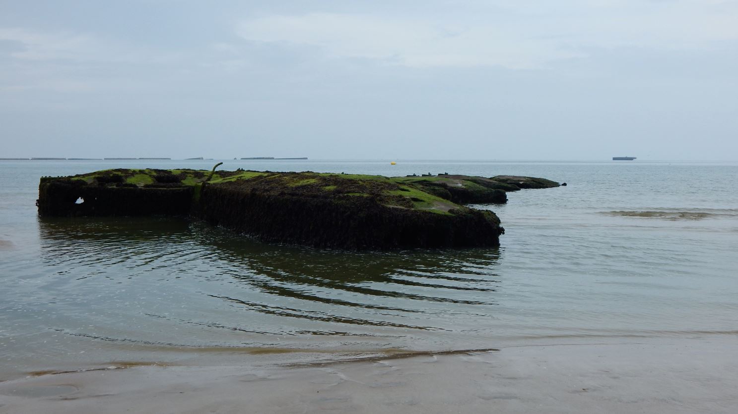 More of the Mulberry remains.


Leave a Reply